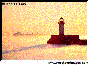
Lighthouses are placed in locations so they can assist navigators to make landfall or avoid hazards. They all have their own distinct shape & color so you can easily distinguish one location from another.
Their main purpose is to hold a light higher to increase the geographic range.
Geographic Range - how far a light can be seen, limited by the curve of the Earth.
Use table 12 in Bowditch to determine the distance to the horizon for a specific height of eye. Use your height of eye to determine how far you can see before the curve of the Earth gets in the way (the horizon). Then look up the distance to the horizon for the object. Geographic Range is the sum of the 2 distances to the horizon.
When will you start to see a lighthouse that is 90-feet tall if your height of eye is 42-feet?
Look up the 2 heights on table 12.
42-ft. = 7.6 nm to the horizon
90-ft. = 11.1 nm to the horizon
7.6 + 11.1 = 18.7 nm Geographic Range
Nominal Range - How far a light can be seen in 10nm of visibility. This is a standard number to compare intensities of lights. Nominal Range is printed on charts and in the Light List/List of Lights. The higher the number, the brighter the night so it can shine through fog & be seen at greater distances.
Need to understand the numbers printed on a chart concerning lighthouses:
FL 5s 90ft 12M - A white light is flashing once every 5 seconds, it stands 90 feet tall and has a nominal range of 12 nm.
Luminous Range - how far a light can be seen in existing visibility. It is limited by the light's intensity and the current visibility.
To find Luminous Range, enter the Luminous Range Diagram on pr. 55 of Bowditch with the Nominal Range of the Light and the current visibility. The arcs on the diagram are the visibility.
Visible Range - how far you will actually see the light. This is limited by the curve of the Earth (G.R.), the intensity of the light (N.R.) and the visibility (L.R.).
First determine the Geographic Range using table 12.
Determine the Luminous Range using the diagram.
Visible Range is the smaller distance - choose G.R. or L. R. - whichever is smaller.